Launches First of Its Kind, Interactive Map Visualizing the Digital Divide in Education
Project Connect, in Partnership with UNICEF’s Office of Innovation

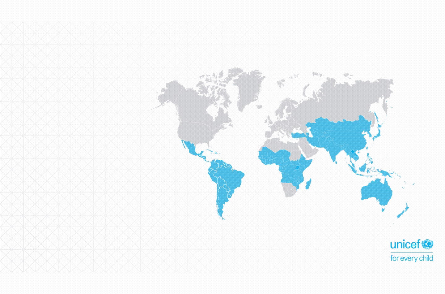
We are excited to announce the launch of Project Connect's interactive map of school locations and internet connectivity. The Ventures Team in UNICEF’s Office of Innovation has worked in partnership with Project Connect since its founding in early 2017 and believes this tool will be a significant resource to its country offices, other international aid organizations, government education agencies, and private sector actors looking to more accurately target education aid and distribute connectivity resources.
The tool is powered by Magic Box, a real-time data platform built by UNICEF Innovation, which will allow for the combination of multiple datasets to create new insights. While this is an alpha version and the tool is still a work in progress, the ultimate goal is for this map to display every school in the world, along with real-time data on each school’s level of Internet connectivity.
Why is this tool so important?
Technology has increasingly become the focus of education aid with funding focused on interventions in schools with access and steady connection to the Internet. However, while many national governments have committed to connecting their schools to the Internet, few have the capability to monitor where that is occurring and on what scale. In parts of the global south, the physical locations of many schools are difficult to identify. This disparity in school location and Internet connectivity knowledge has the potential to increase the digital education divide, as schools already connected to the Internet will receive more technology-based resources while schools currently disconnected will be left behind.
This is where Project Connect comes in. Not only will this platform help governments and international aid actors deliver connectivity to schools currently without or with unreliable Internet, but the data can also be mobilized during emergency response situations to help locate schools, often used as relief centers. This map will remove the current knowledge gap and ensure transparency and accountability in the delivery of education aid and services.